Map
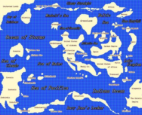
A map is a two-dimensional representation of part of the earth's surface. The earth's surface, of course, is not two-dimensional, which means that maps are a blatant fraud. This form of deceiving the reader was outlawed by the Catholic Church at the end of the 17th century, in favor of more refined scams such as purchased absolutions.
Geographic mapmaking[edit]
The creation and design of geographic maps is called cartography, since the original mapmakers were all cart drivers[1]. This combination of science and art requires the ability not only to draw accurately but to properly measure and scale distances and physical features. Still, this did not stop the early cartographers, who would just wing it, relying on the ability to draw fanciful monsters and amazing mountains and deserts to sell maps. Early map sales were far from brisk, since cartographers drew maps on any handy surface like an oak table or a wall. The invention and widespread use of paper helped maps to become slightly more popular, though maps tended to be used as colorful toilet paper or wall hangings when buyers discovered how inaccurate they were.
Maps were part of an early attempt to teach children things other than acquiring childhood deseases and how to commit crimes. Paper maps would be glued to playground balls with the maps eventually being completely wrapped around them when used in games. The first globes were thus created. Naive children would kick the balls around, notice the maps thereon and would then follow the highly inaccurate maps away from schoolgrounds to their deaths. While this was the perfect solution to school overcrowding, globes were eventually brought into the classroom to bore children during geography lessons to kill their minds rather than their physical bodies.[2]
Other types[edit]
- Brain. Interest in the workings of the human mind led to the theory that certain areas of the brain controlled different processes, movement and emotions. Doctors noted that arrow and axe injuries to various places in the head caused different reactions depending on the location of the wound.[3] They would then scoop out patients' brains to examine the underlying skulls, with no evidence found. It was only after the banning of toxic carbon paper used to record brain injuries that scientists proved their theory that different parts controlled unique processes. Unfortunately, the portion of the brain that controls farts was discovered early on, quickly becoming an obsession with physicians and halting all research into other parts of the human brain.
- Celestial. Early attempts at tracing the positions of stars in the night sky were unsuccessful as the ancients literally tried to trace the night sky with a pencil and a thin sheet of rock. Even artists given huge amounts of amphetamine-type substances would burn out before recording every visible star. Finally, aliens from outer space visited Earth and gave humans the star maps we know today.[4]
- Climate. Maps would be left out for exactly one year in various places. Depending on what happened to the map in that year, a mark would be made on a master map to create a climatic picture of an area. These maps were often found to be missing after a year in place. Hence the frequent notation "here there be dragons" as dragons were known to be fond of eating paper. Most of these maps were probably blown away by the wind and were found hundreds of years later in a garbage dump near Naples, Italy.[5]
History of maps[edit]
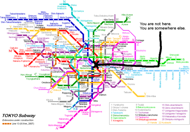
Maps have been employed throughout the ages to illustrate, identify, obfuscate, the exact position of the letter 'X'. X is, of course, the most valuable of mathematical variables, followed by 'Y', and 'Z'. However, almost no one in the Middle Ages cared about the Y of things, and still fewer about the Z. This is because X marks the spot where everything is, and sometimes where something you wanted really badly was, too.
In the age of hunter-gatherers, before there was anything worthwhile in existence, maps showed people how to get from one place to another without being killed along the way. Consequently, maps are greatly missed in places like Baghdad, Antarctica, and Texas. Now, maps are generally ignored by most, and are even ridiculed on road trips as being "for wussies," assuming the driver is male. Meanwhile, children have shown some aptitude at map reading, but they seem unable to refold them correctly.
The Great Library of Alexandria in Egypt was built circa 260 BCE and soon had a map department consisting of over 40,000 scrolls and parchments. It was reputed to cover the known entire world, and included gas station maps from most of the major brands. Unfortunately, there were no maps in Alexandria to enable people to find the Great Library in the first place. Ship captains from other lands would be seen wandering the city streets looking for the library in order to find the out-of-print and now legendary Ptolemy's Guide to the Whorehouses of Alexandria. The vast library itself had no internal maps, so absent-minded scholars would often fail to find the map department but would instead often stumble into the gift shop and be distracted by shiny baubles. Eventually, all the maps were eaten by rats, who then accidentally torched the building while experimenting with using maps as rolling papers.
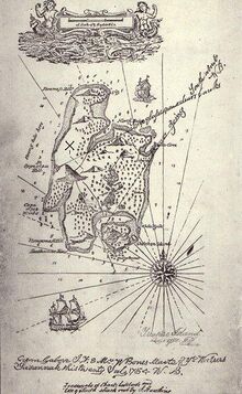
Pirates of the 16th century brought the map to great popularity as a means of recording treasure burial sites. "X" became the favorite method of marking those sites,[6] with merchants doing a brisk business in selling "X" kits, with a large cloth "X" to be used for the treasure location and a tiny "X" to place on the map itself. To throw others off the trail, pirates would cleverly make false maps. Yet, knowing that others would see through the ruse, they would also make copies of the true map and leave them lying around in plain sight. However, knowing that others knew that pirates were doing this, pirates made more and different false maps. This led to so much confusion that no hidden treasure was ever found again.
In 1799, the American Map Treasury burned down due to arson, and, as a consequence, most U.S. Americans today do not have access to maps. Parts of Arkansas, Oklahoma and Pennsyltucky still remain largely unexplored. The rover vehicle Lewis N. Clark was launched in 2007 and successfully landed in Pennsyltucky. However, transmissions mysteriously ended soon after landing, with the only trace of the rover being its suspicious sale on eBay. Efforts have been made to recreate the missing maps but they have all, as yet, failed. The UN is now working on allying the US with Iraq and other Asian countries in order to optimize geography education for us and our children.
In 2017, the US government decreed that the world was indeed flat[7] and outlawed continental drift at the same time. This assured that all existing maps would remain correct forever, much to everyone's relief.[8]
The first maps[edit]
The first map ever produced dates back to the Shang Dynasty (1600 BCE), from the text of the I Ching. Confucius, trying desperately to make his students understand the idea of change, divination, the movement of the body, and the concept of the hot dog, simply gave up after six hours, and sent his favorite whipping-boy Lian Shan to the nearest enemy village to be killed for disrupting class. Directions to the enemy village would not be enough for this doorknob, however, so Confucius scribbled out a crude map. History was made that day, when Lian did not return.
Maps soon evolved from the primitive scribblings of holy men to elaborate illuminated scrolls, sometimes packaged as "atlases." Navigators working for European explorers either had access to secret maps or worked from verbal instructions passed down. If they indeed returned alive from long voyages to the supposed Indies, navigators would make careful maps to show where gold and silver as well as where the women without STDs were. Their maps would be decorated with fanciful or now-extinct creatures such as edible fish. Still, the value of a good map was proven in 1588 by the Spanish Armada. That massive fleet, attempting to conquer Iceland, strayed too close to the British Isles and blundered right into the English fleet led by Sir Francis Drake. This fatal encounter could have easily been avoided by the Spanish if they had only bought the more expensive maps used by fisherman instead of the free auto club ones. Plus, fishermen always knew where the English fleet was at all times to be able to avoid it, as English sailors were particularly tough and flavorless even when caught fresh.
In the 20th Century, people began to use mapping for things other than proving that other things were flat. The insides of computers, robots, and bomb-making materials all had to be carefully mapped, as it is vital in each endeavor not to get the red and green wires mixed up. Coincidentally, Copernicus first postulated that the world was non-flat while jotting down his shopping list on a map of Hell's Kitchen.[9]
Modern uses[edit]
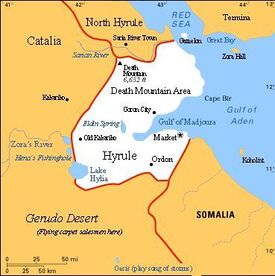
Sometimes on television, a token blonde bimbo will explain a weather pattern using a map festooned with iconic "smiley" sun-faces, sad cloud-faces, and apathetic Henry Kissinger faces. At shopping malls, maps are often displayed in order to point out the nearest haberdashery where velveteen rabbits can be purchased. However, mall maps are made highly reflective, obscuring any details but making them perfect to use as a mirror.
Otherwise, maps are no longer in use today, as they have become totally obsolete. Something called a bookstore, sometimes found in malls, will attempt to sell you paper maps. These can be folded into colorful hats if you desire. However, GPS has completely taken over direction and location finding today, so a map is totally unnecessary. Some people will still carry maps in their cars for ironic value. But then, suppose your car breaks down in the middle of the Sahara Desert where you handy GPS told you to go. Your GPS will tell you your exact position to within a foot (.3 meter). Could a lousy little paper map do that? I think not. As you gradually perish from water loss, you still could make a map into a paper hat as a sunshield if you were the ironic type that had one in the car. But be forewarned that the hat could burst into flame if you accidentally entered a rip in the space-time fabric and ended up on Venus, Mars or even Mercury.[10]
Paper maps are also not used today as they are too confusing, with bright colors and zigzag lines purporting to be roads and highways. Is that red line a street or building outline? One never knows for sure. Who do they think they are fooling? It is far better to rely on one's own traditional driving instinct. That is, to drive slowly while hunched over the wheel with a worried look on one's face. It is particularly useful when passing through sketchy neighborhoods or anywhere where people are walking around with automatic weapons or rocket launchers. Sooner or later, a passerby will notice your dilemma and approach your car to help out. They may actually be approaching you to help themselves out, but beggars can't be choosers.
With this disuse came the loss in many people of the ability to refold road maps. Now only certified masters of Japanese origami can refold and fold maps at will. Some talented amateurs have been able to refold paper maps but only after years of earnest study and suffering from many hundreds of infected paper cuts. Nowadays, beginners are strongly discouraged from refolding maps. Despite this, hundreds are found dead each year after having attempted refolding a map on their own. Legislation has recently been passed (2018) in states with nanny laws that require maps to be securely packaged with a warning on them to only open a map in an emergency and to dispose of it without attempting to read or refold it.
Maps in gaming[edit]
While board games could often have a map element to them, it was not until the computer-based role-playing game (RPG) Colossal Cave Adventure was created (circa 1975), that mapmaking skills were found to be totally lacking in the nerd community. As the game expanded in size, pure memorization skills no longer helped the player who often wished they had paid attention during geography class and had learned left from right from mommy[11]. Without a self-created map, the player could easily end up in "a maze of twisting little passages, all different". Thus, pencils became important in nerd culture aside from being used to pick noses, extract earwax or being used as an impromptu butt scratcher.
Dungeons and Dragons extended RPG complexity and emphasized the need for proper mapmaking skills more than ever. This led to a renaissance of sorts in cartography where some players would create elaborately decorated maps just for sheer joy of it. That joy would be tempered by some of them being burned as witches for being able to find their way in the real world using a map. Nonetheless, many RPG mapmakers went on to become mall map designers, taking revenge for their brethren by giving wrong or vague directions to bathrooms. A need for mapmaking skills would be extended to computer games in general, leading to more tolerance of people who know how to read maps. Today, this is demonstrated by the fact that map readers are merely stuffed into toaster ovens rather than being burned at the stake.
The use of maps with escape rooms are a popular feature of parties today. A group is sent into a room that is locked until they can solve a variety of puzzles with a map often a key feature of the game. Hilarity ensues since people are generally no longer are able to interpret maps. They then can never leave the room, leaving plenty of food and drink to be enjoyed by the other guests. After a preset time, the floor drops away in the escape room and participants are dumped into deep underground grottos. The next group and the next group enter until finally the host is left with peace and quiet.
Online map systems[edit]
Google maps are virtual maps that display on a smartphone or computer and are guaranteed to cause your death as they show roads and highways as they were 20 or more years ago. People note the frequent sighting of Google camera vehicles worldwide to be a sign of constant updating. However, it must be noted that they are all just lost since they are using the outdated maps that Google bought from other map companies. The innovative Google Street View is actually a collection of images of a 4 block-square area in Baltimore, Maryland, as the same carjackers can be seen over and over again hanging around the same streetcorner.
Critics have pointed out that the 2-dimensional nature of basic Google maps is a danger. Every year, many motorists find themselves stranded atop Mt. Everest after making a wrong turn and dozens die each year running into airliners in flight. Google's decision to provide a map of the Moon has also been questioned, as drivers have somehow been able to find their way there and perished due to lack of oxygen.
Fans of Super Mario Kart and the Grand Theft Auto game franchise have hacked Google maps so that it will draw a direct line from your point of origin to your destination. While this indeed is the fastest route, it is recommended that users of this modification also upload the other cheat codes to their vehicle as a minimal precaution.
Bing in conjunction with Microsoft and Apple Inc. rolled out their versions of online maps in 2006 and 2012 respectively. The haha competitors to Google were hahaha found to be far hahahahahaha, to be far hahahahaha, to be hahahahahahahahahahahaha, slightly hahahahahahahahaheeheeheee. Heh.[12]
To run properly with all features enabled, a Cray computer is recommended for any of the above map systems. Users should allow approximately 2 hours before a usable map can be viewed.
See also[edit]
- Bad Directions
- Post-cartography
- Buried treasure
- Geocaching
- Nike Revolution of 2006
- GPS
- Dungeons and Dragons
Footnotes[edit]
- ↑ Led by Carter the Unstoppable Sex Machine. Warhol, Andy Fifteen Minutes of Fame pg. 77. Wolfgang Press (1992)
- ↑ For an alternate explanation see The Flat Earth Society Bluebook (1957).
- ↑ other than the expected screaming and arm flailing
- ↑ Aliens believed the sky was flat as proven by the maps they handed down. While this is undoubtedly true, it contradicts the existence of a flat Earth.
- ↑ or placed there by dragons as nesting material. Audobon Society Magazine pg. 35-36 (July 1932)
- ↑ Scholars wonder why "R" did not not become popular. Piracy Journal of Bermuda (December 1998). Retrieved March 2019.
- ↑ because maps are
- ↑ AAAAAAAAA!
- ↑ Ironically, Copernicus was a 2-dimensional being. "Copernicus: Bipolar Pole?" National Enquirer pg. 55 (12 September 2011).
- ↑ Titor, John. Owwwwww personal correspondence (2012).
- ↑ As if she even knew. Abby, Dear "Forget Something in the Shopping Cart Again?" Ladies Home Journal pg. 44 (7 January 1967)
- ↑ Srsly, heeheehahahahahahaha
