File:Map of USA Inland Northwest.png
Jump to navigation
Jump to search
No higher resolution available.
Map_of_USA_Inland_Northwest.png (280 × 183 pixels, file size: 17 KB, MIME type: image/png)
Summary[edit]
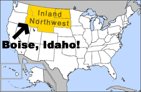
Inland Northwest. Original image from: http://en.wikipedia.org/wiki/Image:Map_of_USA_highlighting_North_Dakota.png
Licensed as "Permission is granted to copy, distribute and/or modify this document under the terms of the GNU Free Documentation License, Version 1.2 or any later version published by the Free Software Foundation; with no Invariant Sections, no Front-Cover Texts, and no Back-Cover Texts."
Licensing[edit]
 |
Permission is granted to copy, distribute, modify, huff
and/or misuse this document under the terms of the Or not. You decide. |
File history
Click on a date/time to view the file as it appeared at that time.
| Date/Time | Thumbnail | Dimensions | User | Comment | |
|---|---|---|---|---|---|
| current | 04:06, 13 June 2006 | | 280 × 183 (17 KB) | Un-I-Wanna-Be-Known-by-IP (talk | contribs) | Inland Northwest. Original image from: http://en.wikipedia.org/wiki/Image:Map_of_USA_highlighting_North_Dakota.png Licensed as "Permission is granted to copy, distribute and/or modify this document under the terms of the GNU Free Documentation License, V |
You cannot overwrite this file.
File usage
The following page uses this file: