File:DisneylandMap.jpg
Jump to navigation
Jump to search
No higher resolution available.
DisneylandMap.jpg (600 × 413 pixels, file size: 93 KB, MIME type: image/jpeg)
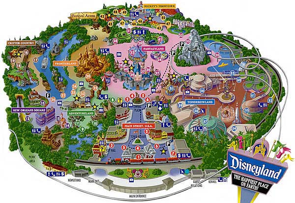
A map of Disneyland Park. The eight nations of Disneyland, Critter Country, Frontierland, Adventureland, Tommorowland, New Orleans Square, Mickey's Toontown, Fantasyland, and Main Street are all shown here united under the regime of Mickey Mouse the Great.
This image is possibly too serious to be Uncyclopedic. You can help Uncyclopedia by Photoshopping it in a more humorous way or moving it to TFAODP.
Used without permission under Fair Use. Downloaded from Intercot West.
File history
Click on a date/time to view the file as it appeared at that time.
| Date/Time | Thumbnail | Dimensions | User | Comment | |
|---|---|---|---|---|---|
| current | 06:42, 15 August 2005 | | 600 × 413 (93 KB) | KP (talk | contribs) | A map of Disneyland Park. Used without permission under Fair Use. Downloaded from [http://www.intercotwest.com/resortGuide/maps.asp Intercot West]. |
You cannot overwrite this file.
File usage
The following 4 pages use this file: